
At the Museum of Wrecks, we maritime archaeologists usually conduct our own dives to examine and document shipwrecks and other underwater remains. But some sites lie too deep – beyond 40 metres, which is the limit when we dive with air or oxygen-enriched air (nitrox). As we know, the deeper the dive, the shorter the time that can be safely spent at the bottom to avoid decompression sickness. To give an example, according to our dive tables, a dive to 39 metres allows for 12 minutes on air (21% oxygen) or 15 minutes on nitrox (28% oxygen). After a 4–5-hour surface interval, we can do a second dive on the same day but only for 10 minutes.
When the remains lie too deep for diving, we turn to technology – specifically, remotely operated underwater vehicles (ROVs), also known as underwater drones. An ROV is essentially a small submersible connected to the surface by a cable. The operator controls it from a computer or, in simpler models, a mobile phone, while viewing a live camera feed from the vehicle.
ROVs range from basic models costing a few thousand dollars to advanced drones worth millions. Their price depends on factors like the maximum operating depth, dive duration and image quality.
In Sweden, ROVs are used by the Coast Guard, the Police and maritime archaeologists, among others. They also play a crucial role in underwater inspections for oil drilling platforms, in geological surveys and other subaquatic work.
In recent years, we at the museum have worked extensively with ROV footage. For example, we have received ROV recordings of wreck sites from external partners, such as the Coast Guard. In these cases, our archaeologists have been able to analyse the footage in the office and produce archaeological reports based on their findings.
ROVs are also used for large-scale archaeological surveys far out at sea. In these cases, operators hire professional survey vessels equipped with sonar, multibeam and ROVs. Some wrecks are difficult to detect using sonar mapping alone and can only be identified through ROV footage. One such example is a ship carrying a cargo of medieval roof tiles. On sonar scans, the site appeared to be nothing more than a collection of small natural stones on the seabed, but the ROV footage clearly revealed a load of tiles aboard a sunken ship.
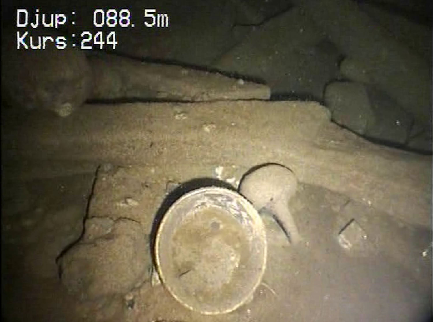
A still image from ROV footage showing a barrel and a bottle at a shipwreck from around the year 1700. Photo: Swedish Coast Guard.
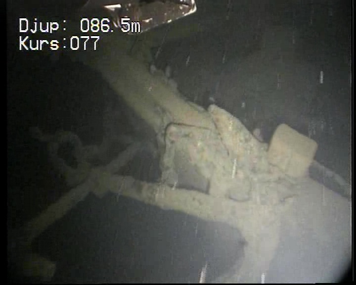
A still image from ROV footage showing an anchor in the bow of a ship that sank in the 1930s. Photo: Swedish Coast Guard.
Using our own ROV, we have surveyed wrecks along the coasts, either to quickly verify whether a sonar indication is a shipwreck or to determine whether a wreck or its parts are too deep for our team to reach. In Hargshamn, we used the ROV despite the shallow depth to directly verify wreck positions identified by sonar, allowing us to avoid diving and complete the work with just two people. Typically, diving operations require a team of three, as mandated by law.
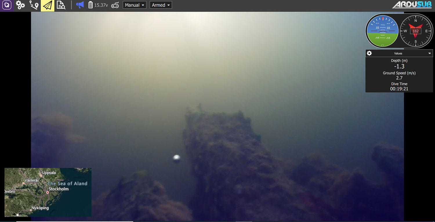
This is what the computer screen looked like when we operated the ROV on one of several wooden wrecks in Hargshamn. The visible parts are the frames. Photo: SMTM.
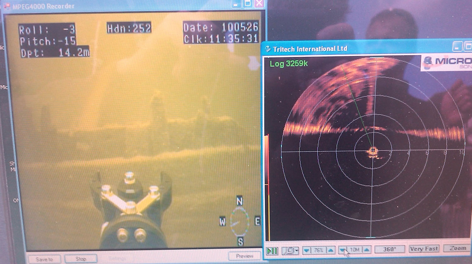
This is what the computer screen looked like when we operated the ROV on the Anna Maria in Dalarö. The hull side and the frames are visible. A sonar is often used as well, aiding navigation in poor visibility. Photo: SMTM.
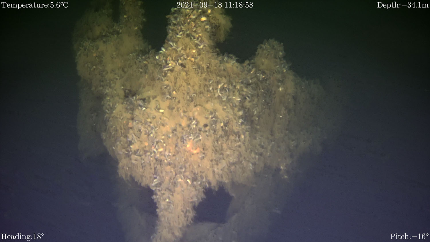
More recently, in Oskarshamn, we conducted a dive to investigate the paddle steamer Malmöhus, which lies at a depth of about 38 metres. We used the ROV to explore the deepest part of the wreck, as dive times at this depth are very limited for both air and nitrox diving. The ROV had just returned from a service and upgrade, and we had completed a brief training session in a pool.
One disadvantage of ROVs compared to archaeologist divers is that diving gives you a completely different perspective on a wreck site. Divers can easily examine objects more closely, and sometimes even physically interact with them, which isn’t possible with an ROV. Viewing a wreck on a computer screen is somewhat like looking through a narrow tube, while as a diver, you have a more comprehensive, all-around view, allowing for a quicker and clearer understanding of the site as a whole.
